![]()
![]()
![]()
![]()
![]()
![]()
|
|
|
|
This page shows the operation of DXView
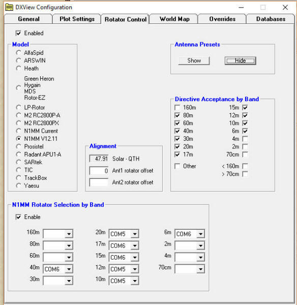
If you need more than on rotator control you can use N1MM rotator control version 12.11.2 only, apparently other versions do not interface with DXLab. This version is available from DXLab forum on Yahoo.
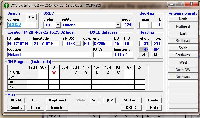
In my spot collector I double clicked on OH1VR and it appears in the DXView window. The rest of the line gives you all info about that contact i.e. prefix, entity and country code. The very top line shows the version, date and Zulu time. The GeoMag information is also given as well as Lat/Lon distance (Sp DX), continent, grid square, CQ and ITU zones. It also shows location, IOTA (if applicable), and the UTC time zone. DXView also checks my log and shows that I have confirmed on the bands indicated by a C or V which means verified with ARRL, a W means worked but not confirmed. When you click on World it will either bring up the DXLab atlas or DX Atlas showing prop path etc. Country is a map showing what the country looks like, MapQuest gives you driving directions and Google is Google Earth. You need to install Google Earth separately so that when you click on it Google Earth launches and takes you to that location, really cool app. The other buttons are translate (Xlate), sunrise/sunset (Sun), Ignore lookup requests from spot collector (DC Lock), Config, QRZ lookup, edit DXCC database (DXCC) and help. We will get to Config later. Note the Heading box which gives you the short path (SP) or the long path (LP) in degrees. If you have a rotator, clicking on SP or LP will turn the antenna to tha location, provided you have an interface and it is setup. There are also presets as well as user defined locations. Remember, if you hover your mouse pointer over any button it will show you the function it performs.
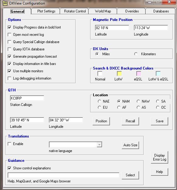
This is the first tab on the config screen. Set your continent location, mine is NAM for North America Midwest. I set my DX units to miles and I checked dual monitors. I don't find translation particularly useful but I left it checked. You can change the background colors for DXCC but I don't see the need. You should enter your Lat/Lon and save it.
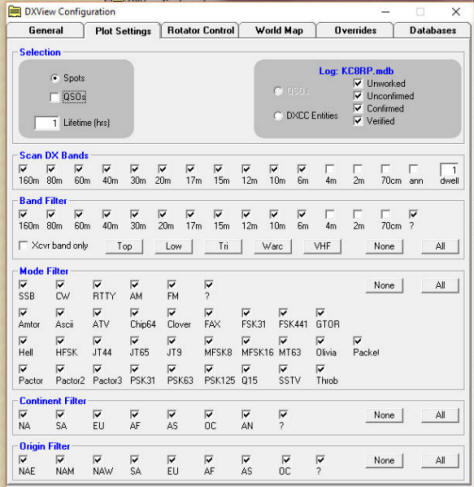
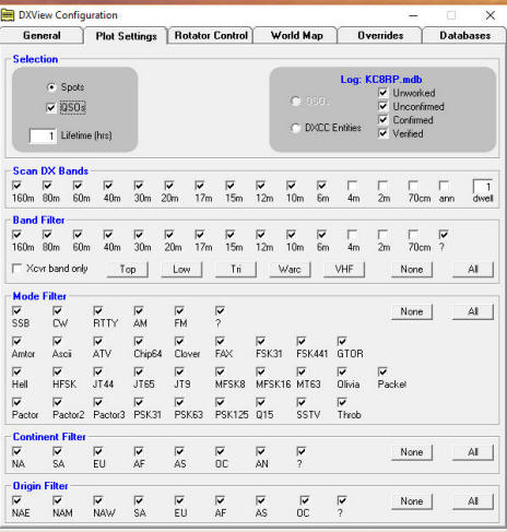
This screen sets up your map plots, use as you see fit and experiment. You cannot hurt anything but beware, if you check QSOs in the the map will get real messy, click the photos above the see the results.
I have a Yaesu G-2800DXA rotator with an Idiom Press interface and the G-800DXA with the MDS RC-1 interface. You will need to set your rotator according to the interface you have, REMEMBER to check enable. This is where you will setup for N1MM if you need 2 or more rotators.
This screen determines which map to load, DXLabs built in map or DX Atlas. From the screen you can see I have DX Atlas activated. I recommend DX Atlas, I will show it in another page. A new feature is Goggle Earth which can also display spot information.
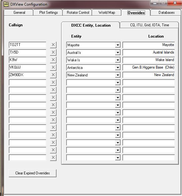
This screen is useful if you have a problem call sign that will not log correctly. This is the same information used in the Spot Collector overrides.
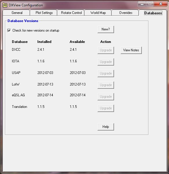
This screen is used to update the different databases. Make sure "Check for new version on startup" is checked. When you launch "DXLauncher" it will inform you of any new databases. This is a real nice feature since it alerts you to any new databases and allows you a simple click to upgrade. If you have used other logging programs you will realize this is not automatic or simple. |